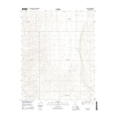
2014 Map of Dike Tank
USGS Topo · Published 2014About this map
Albers Wash cuts through this high plateau region of Coconino County, where the landscape is defined by the critical management of water in an arid environment. The map highlights a network of catchment systems such as Dike Tank, Rose Tank, and Buck Tank, which serve as vital landmarks and resources in this section of the Kaibab Plateau. These features, along with Southeast Tank and Hog Ranch Tank, reflect the ranching or wildlife management history of the area. A grid of Bureau of Indian Affairs routes, including Bia-12 and Bia-14, provides the primary infrastructure for navigating the township and range divisions. The contour lines reveal the complex drainage patterns and relief typical of the northern Arizona uplands, documenting the terrain as it remained in the early 21st century.
Find a feature on this map
16 named features on this map. Tap any name to fly to it.
Don’t see what you’re looking for? This feature index may not catch every label — zoom into the map to look around manually.
Map Details
Editions of this 2014 Dike Tank Map
This is the sole edition of this map. No revisions or reprints were ever made.
Other maps of this area

1886 · Diamond Creek
USGS Topo · 1:250,000

1886 · Chino
USGS Topo · 1:250,000

1891 · Chino
USGS Topo · 1:250,000

1892 · Diamond Creek
USGS Topo · 1:250,000

1948 · Williams
USGS Topo · 1:250,000

1954 · Williams
USGS Topo · 1:250,000

1956 · Williams
USGS Topo · 1:250,000

1960 · Williams
USGS Topo · 1:250,000

1961 · Williams
USGS Topo · 1:250,000
1967 · Frazier Wells
USGS Topo · 1:24,000