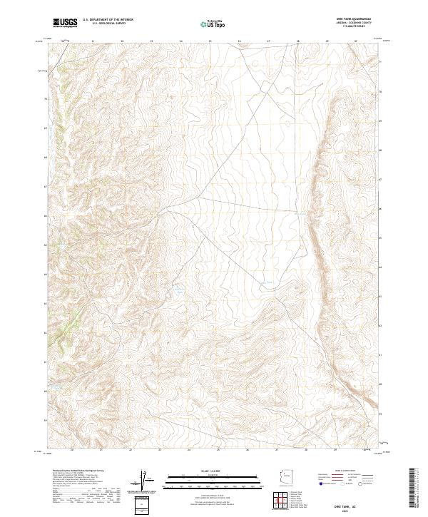
2021 Map of Dike Tank
USGS Topo · Published 2021About this map
Water management defines the High Desert landscape of Coconino County on this 2021 survey, where isolated catchments serve as the primary landmarks in an arid expanse. The drainage of Albers Wash cuts through the western section, while the remainder of the terrain is marked by essential livestock or wildlife watering points such as Dike Tank, Rose Tank, and Southeast Tank. These small reservoirs, including Buck Tank and the specifically named Hog Ranch Tank, indicate a land use dedicated to ranching or range management rather than permanent residential settlement. The topographic detail captured by the U.S. Geological Survey illustrates the subtle relief and drainage patterns that dictate the placement of these vital water sources across the township and range system.
Find a feature on this map
12 named features on this map. Tap any name to fly to it.
Don’t see what you’re looking for? This feature index may not catch every label — zoom into the map to look around manually.
Map Details
Editions of this 2021 Dike Tank Map
This is the sole edition of this map. No revisions or reprints were ever made.
Other maps of this area

1886 · Diamond Creek
USGS Topo · 1:250,000

1886 · Chino
USGS Topo · 1:250,000

1891 · Chino
USGS Topo · 1:250,000

1892 · Diamond Creek
USGS Topo · 1:250,000

1948 · Williams
USGS Topo · 1:250,000

1954 · Williams
USGS Topo · 1:250,000

1956 · Williams
USGS Topo · 1:250,000

1960 · Williams
USGS Topo · 1:250,000

1961 · Williams
USGS Topo · 1:250,000
1967 · Frazier Wells
USGS Topo · 1:24,000