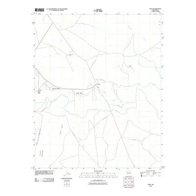
2010 Map of Dilia
USGS Topo · Published 2010About this map
The Pecos River carves a deep valley through this Guadalupe County landscape, defining the placement of small agricultural settlements and ranching operations. In the early 21st century, the corridor along Llano Del Medio and Upper Dilia remains anchored by traditional land use, where the river's path is flanked by the rising land of Mesa De La Chamizalosa. This area shows a cluster of localized place names like Llano Viejo and the La Loma Post Office, indicating a community structure tied closely to the topography of the valley floor.
Find a feature on this map
16 named features on this map. Tap any name to fly to it.
Don’t see what you’re looking for? This feature index may not catch every label — zoom into the map to look around manually.
Map Details
Editions of this 2010 Dilia Map
This is the sole edition of this map. No revisions or reprints were ever made.
Other maps of this area

1890 · Bernal
USGS Topo · 1:125,000

1891 · Bernal
USGS Topo · 1:125,000

1892 · Corazon
USGS Topo · 1:125,000

1894 · Corazon
USGS Topo · 1:125,000

1894 · Bernal
USGS Topo · 1:125,000

1954 · Santa Fe
USGS Topo · 1:250,000

1958 · Santa Fe
USGS Topo · 1:250,000

1960 · Apache Springs
USGS Topo · 1:62,500

1963 · Pedro Miguel Peak
USGS Topo · 1:24,000
1963 · Thompson Ranch
USGS Topo · 1:24,000