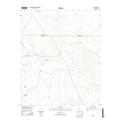
2013 Map of Dilia
USGS Topo · Published 2013About this map
The Pecos River carves through this New Mexico landscape, creating a fertile valley where the historic settlements of Dilia, Llano del Medio, and Upper Dilia are concentrated. This area, spanning the border of San Miguel and Guadalupe counties, illustrates a rural economy centered on the river and specific water sources like Salitre Spring and Chupinas Spring. Cattle ranching is a visible part of the local history, with the Abercrombie Ranch and Sowell Ranch established among the mesas and canyons. Topographically, the map is dominated by the steep rises of Mesa de la Chamizalosa and the deep cuts of Cañon Blanco and Cañon de Rancho Alegre. The road network, including NM-119 and the local Dilia Loop, connects these small communities and ranching outposts along the river corridor.
Find a feature on this map
22 named features on this map. Tap any name to fly to it.
Don’t see what you’re looking for? This feature index may not catch every label — zoom into the map to look around manually.
Map Details
Editions of this 2013 Dilia Map
This is the sole edition of this map. No revisions or reprints were ever made.
Other maps of this area

1890 · Bernal
USGS Topo · 1:125,000

1891 · Bernal
USGS Topo · 1:125,000

1892 · Corazon
USGS Topo · 1:125,000

1894 · Corazon
USGS Topo · 1:125,000

1894 · Bernal
USGS Topo · 1:125,000

1954 · Santa Fe
USGS Topo · 1:250,000

1958 · Santa Fe
USGS Topo · 1:250,000

1960 · Apache Springs
USGS Topo · 1:62,500

1963 · Pedro Miguel Peak
USGS Topo · 1:24,000
1963 · Thompson Ranch
USGS Topo · 1:24,000