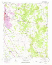
1956 Map of Dillton
USGS Topo · Published 1977About this map
The eastern expansion of Murfreesboro dominates the western edge of this landscape, showing the growth of the Middle Tennessee State College campus and residential areas along Broadway. Moving east into Rutherford County, the terrain shifts from the urbanized college town to a rural network of small communities and crossroads settlements such as Double Springs and Dillton. The area is densely dotted with community institutions that served local families, including St Rose of Lima Sch, Gladeview Sch, and numerous country churches like Mt Hermon Ch and Haynes Chapel.
Find a feature on this map
51 named features on this map. Tap any name to fly to it.
Don’t see what you’re looking for? This feature index may not catch every label — zoom into the map to look around manually.
Map Details
Editions of this 1956 Dillton Map
3 editions found

Other maps of this area

1908 · Woodbury
USGS Topo · 1:62,500

1913 · Hollow Springs
USGS Topo · 1:62,500

1916 · Murfreesboro
USGS Topo · 1:62,500

1936 · Webbs Jungle
USGS Topo · 1:24,000

1936 · Beech Grove
USGS Topo · 1:24,000

1936 · Fosterville
USGS Topo · 1:24,000

1942 · Statesville
USGS Topo · 1:100,000

1942 · Lebanon
USGS Topo · 1:100,000

1943 · Mc Minnville
USGS Topo · 1:100,000

1944 · Shelbyville
USGS Topo · 1:100,000