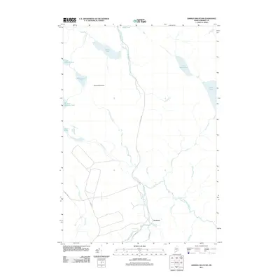
2011 Map of Dimmick Mountain
USGS Topo · Published 2011About this map
Dimmick Mountain stands as the central landmark of this Somerset County landscape, which is defined by an intricate network of waterways and a legacy of timber and transport. The southern portion of Moxie Pond and the expansive Baker Pond feed into a web of drainages including Baker Stream and Wild Brook. One of the most distinctive historical markers is Old Railroad Rd, which cuts a north-south line through the center of the terrain, tracing a former path of commerce toward the Deadwater region. This low-lying area near Austin Stream Falls reveals the natural bottlenecks and water power locations that were vital to early Maine industry. To the west, the landscape rises toward Heald Ponds and several smaller basins like Little Dimmick Pond, illustrating the glacial hydrology of the Maine woods.
Find a feature on this map
24 named features on this map. Tap any name to fly to it.
Don’t see what you’re looking for? This feature index may not catch every label — zoom into the map to look around manually.
Map Details
Editions of this 2011 Dimmick Mountain Map
This is the sole edition of this map. No revisions or reprints were ever made.
Other maps of this area

1903 · Bingham
USGS Topo · 1:62,500

1905 · Bingham
USGS Topo · 1:62,500

1905 · The Forks
USGS Topo · 1:62,500

1907 · The Forks
USGS Topo · 1:62,500

1948 · Kingsbury
USGS Topo · 1:62,500

1950 · Kingsbury
USGS Topo · 1:62,500

1951 · Greenville
USGS Topo · 1:62,500

1954 · Millinocket
USGS Topo · 1:250,000

1956 · The Forks
USGS Topo · 1:62,500

1956 · Bingham
USGS Topo · 1:62,500