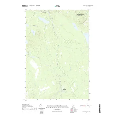
2021 Map of Dimmick Mountain
USGS Topo · Published 2021About this map
The settlement of Deadwater marks the southern reach of this Somerset County landscape, where the waters of Austin Stream flow southward through a network of remote timberlands. This modern survey illustrates the rugged high-country character of the region, anchored by the peaks of Dimmick Mtn and Bald Mtn. The Appalachian National Scenic Trail winds through the northern portion of the map, tracing a path above Baker Pond and Little Austin Pond. This area is defined by its industrial and recreational access, shown through a series of named forest routes including Deadwater Rd, Heald Pond Rd, and Baker Dimmock Rd. The presence of Austin Stream Falls and several brook crossings like Bassett Brook highlights the intricate drainage patterns that have shaped this interior Maine territory.
Find a feature on this map
19 named features on this map. Tap any name to fly to it.
Don’t see what you’re looking for? This feature index may not catch every label — zoom into the map to look around manually.
Map Details
Editions of this 2021 Dimmick Mountain Map
This is the sole edition of this map. No revisions or reprints were ever made.
Other maps of this area

1903 · Bingham
USGS Topo · 1:62,500

1905 · Bingham
USGS Topo · 1:62,500

1905 · The Forks
USGS Topo · 1:62,500

1907 · The Forks
USGS Topo · 1:62,500

1948 · Kingsbury
USGS Topo · 1:62,500

1950 · Kingsbury
USGS Topo · 1:62,500

1951 · Greenville
USGS Topo · 1:62,500

1954 · Millinocket
USGS Topo · 1:250,000

1956 · The Forks
USGS Topo · 1:62,500

1956 · Bingham
USGS Topo · 1:62,500