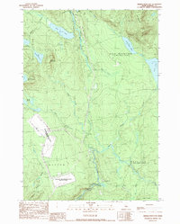
1989 Map of Dimmick Mountain
USGS Topo · Published 1989About this map
The Moscow Air Force Station Transmit Site dominates the southwestern portion of this Somerset County landscape, marked by its large footprint and a network of supporting infrastructure including a substation and a Double Wooden Pole Transmission Line. This specialized military installation contrasts with the surrounding wilderness of the Caratunk and Moscow areas, where the Appalachian Trail winds through the northern heights. The terrain is defined by a series of prominent peaks and water bodies, notably Dimmick Mountain and its namesake ponds, alongside the expansive Baker Pond. Further east, the Austin Stream creates significant natural features such as Austin Stream Falls and the Deadwater, while the township of Mayfield provides a glimpse into the remote, forest-managed boundaries of central Maine during the late twentieth century.
Find a feature on this map
30 named features on this map. Tap any name to fly to it.
Don’t see what you’re looking for? This feature index may not catch every label — zoom into the map to look around manually.
Map Details
Editions of this 1989 Dimmick Mountain Map
This is the sole edition of this map. No revisions or reprints were ever made.
Other maps of this area

1903 · Bingham
USGS Topo · 1:62,500

1905 · Bingham
USGS Topo · 1:62,500

1905 · The Forks
USGS Topo · 1:62,500

1907 · The Forks
USGS Topo · 1:62,500

1948 · Kingsbury
USGS Topo · 1:62,500

1950 · Kingsbury
USGS Topo · 1:62,500

1951 · Greenville
USGS Topo · 1:62,500

1954 · Millinocket
USGS Topo · 1:250,000

1956 · The Forks
USGS Topo · 1:62,500

1956 · Bingham
USGS Topo · 1:62,500