
1968 Map of Dimple Hills
USGS Topo · Published 1971About this map
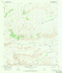
W B Flats dominates the northern horizon of this West Texas landscape, where the high desert terrain transitions into the distinct elevations of the Dimple Hills and Sugar Loaf Mountain. Surveyed in the late 1960s, the map illustrates a remote ranching economy dependent on scattered water sources like Gurley Windmill and Peters Windmill. The isolation of the region is underscored by the Pecos and Brewster County line, which cuts diagonally across the terrain with few signs of human development beyond the League Ranch and a lone Corral. Natural drainage patterns define the geography, with the winding paths of Big Canyon, Eighty Draw, and Red Mill Draw carving through the arid flats. This topographic study captures a specific moment in the land management of the Trans-Pecos, documenting the vital infrastructure of tanks and windmills that sustained life in this expansive territory.
Find a feature on this map
14 named features on this map. Tap any name to fly to it.
Don’t see what you’re looking for? This feature index may not catch every label — zoom into the map to look around manually.
Map Details
Editions of this 1968 Dimple Hills Map
This is the sole edition of this map. No revisions or reprints were ever made.
Other maps of this area

1920 · Longfellow
USGS Topo · 1:125,000

1920 · Marathon
USGS Topo · 1:62,500

1921 · Marathon
USGS Topo · 1:62,500

1923 · Hess Canyon
USGS Topo · 1:62,500

1954 · Fort Stockton
USGS Topo · 1:250,000

1958 · Fort Stockton
USGS Topo · 1:250,000

1968 · Housetop Mountains
USGS Topo · 1:24,000

1968 · Cap Rock Butte
USGS Topo · 1:24,000

1968 · Marathon Gap
USGS Topo · 1:24,000
1968 · Reininger Draw
USGS Topo · 1:24,000