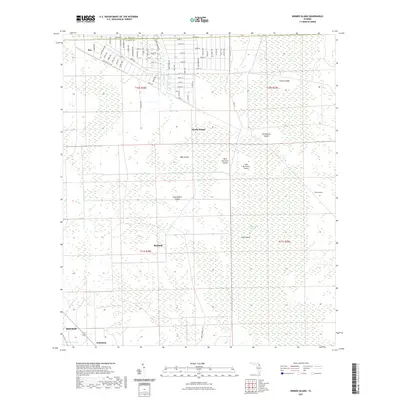
2021 Map of Dinner Island
USGS Topo · Published 2021About this map
Bunnell and the unincorporated community of Roy anchor the northern landscape of this Florida interior, where the St Johns Co Flagler Co boundary line divides a complex network of wetlands and named land-rises. This low-lying region is characterized by a series of "islands"—elevated hammocks or ridges within the larger marshy ecosystem—including Turkey Island, Myrtle Island, and Old Dinner Island. The presence of Big Cypress Swamp and water bodies like Sixteenmile Cr and Salt Cr illustrate the drainage patterns of the coastal plain.
Find a feature on this map
76 named features on this map. Tap any name to fly to it.
Don’t see what you’re looking for? This feature index may not catch every label — zoom into the map to look around manually.
Map Details
Editions of this 2021 Dinner Island Map
This is the sole edition of this map. No revisions or reprints were ever made.
Other maps of this area

1912 · Palatka
USGS Topo · 1:48,000

1915 · Palatka
USGS Topo · 1:62,500

1937 · Dinner Island
USGS Topo · 1:48,000

1943 · Dinner Island
USGS Topo · 1:62,500

1944 · Dinner Island
USGS Topo · 1:62,500

1954 · Daytona Beach
USGS Topo · 1:250,000

1956 · Dinner Island NE
USGS Topo · 1:24,000
1957 · Espanola
USGS Topo · 1:24,000

1958 · Daytona Beach
USGS Topo · 1:250,000

1964 · Daytona Beach
USGS Topo · 1:250,000