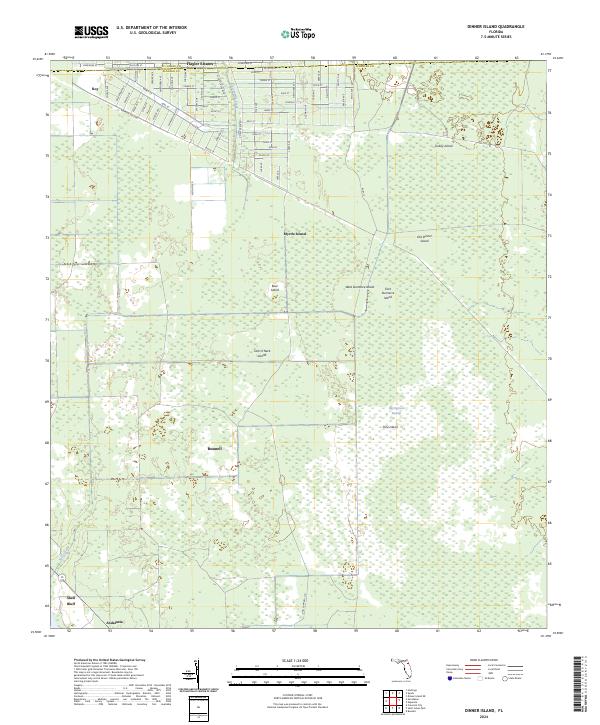
2024 Map of Dinner Island
USGS Topo · Published 2024About this map
Flagler Estates straddles the county line between St Johns and Flagler counties, marking a significant planned grid of streets that contrasts sharply with the surrounding wetlands. To the south, the terrain transitions into the dense, marshy expanses of the Big Cypress Swamp. The landscape is dotted with distinct hammock-like features such as Old Dinner Island, Bear Island, and Turkey Island, which rise slightly above the swampy lowlands. Waterways like Sixteenmile Creek and Salt Creek snake through the region, while the southern boundary includes the settlement of Andalusia near Shell Bluff. This contemporary survey highlights the ongoing intersection of residential development and Florida’s traditional swamp ecology, particularly visible where the rigid geometry of roads like Potatoe Ville Rd meets the irregular contours of the wetlands.
Find a feature on this map
75 named features on this map. Tap any name to fly to it.
Don’t see what you’re looking for? This feature index may not catch every label — zoom into the map to look around manually.
Map Details
Editions of this 2024 Dinner Island Map
This is the sole edition of this map. No revisions or reprints were ever made.
Other maps of this area

1912 · Palatka
USGS Topo · 1:48,000

1915 · Palatka
USGS Topo · 1:62,500

1937 · Dinner Island
USGS Topo · 1:48,000

1943 · Dinner Island
USGS Topo · 1:62,500

1944 · Dinner Island
USGS Topo · 1:62,500

1954 · Daytona Beach
USGS Topo · 1:250,000

1956 · Dinner Island NE
USGS Topo · 1:24,000
1957 · Espanola
USGS Topo · 1:24,000

1958 · Daytona Beach
USGS Topo · 1:250,000

1964 · Daytona Beach
USGS Topo · 1:250,000