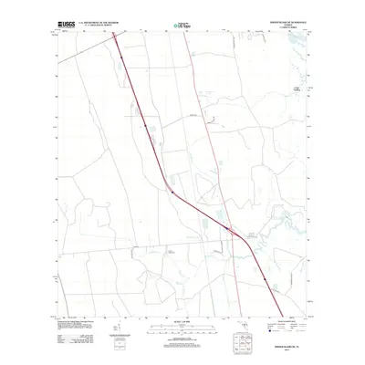
2012 Map of Dinner Island NE
USGS Topo · Published 2012About this map
Pellicer Creek flows through the lowlands south of the Matanzas River, defining a landscape of tidal drainage and established rural routes in the early 2010s. This coastal Florida environment is marked by a network of family-named roads and waterways, such as Harry Pringle Road and Stevens Branch. The presence of the Pellicer Creek Cemetery near the junction of Pellicer Creek and its tributaries offers a significant point of interest for genealogists tracing local families. The map also captures the interface between development and the natural shoreline at Cedar Landing. Connectivity across the wetlands is shown through established corridors like Faver Dykes Road and Old Kings Road North, providing a clear view of how transit and settlement are shaped by the many branches, including Schoolhouse Branch and Cracker Branch.
Find a feature on this map
22 named features on this map. Tap any name to fly to it.
Don’t see what you’re looking for? This feature index may not catch every label — zoom into the map to look around manually.
Map Details
Editions of this 2012 Dinner Island NE Map
This is the sole edition of this map. No revisions or reprints were ever made.
Other maps of this area

1927 · Matanzas
USGS Topo · 1:48,000

1937 · Elkton
USGS Topo · 1:24,000

1937 · Crescent Beach
USGS Topo · 1:24,000

1937 · Dinner Island
USGS Topo · 1:48,000

1943 · St. Augustine
USGS Topo · 1:62,500

1943 · Dinner Island
USGS Topo · 1:62,500

1943 · Matanzas
USGS Topo · 1:62,500

1944 · Dinner Island
USGS Topo · 1:62,500

1944 · Matanzas
USGS Topo · 1:62,500

1954 · Daytona Beach
USGS Topo · 1:250,000