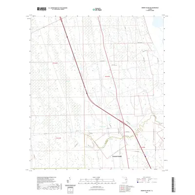
2021 Map of Dinner Island NE
USGS Topo · Published 2021About this map
Pellicer Creek winds across the landscape, marking the historic boundary line between St Johns Co and Flagler Co. This modern topographic study reveals a terrain defined by extensive wetlands, including Fish Swamp and Pringle Swamp, alongside several named tributaries like Schoolhouse Br and Cracker Br. While the southern portion shows the encroaching development of Palm Coast, much of the area remains protected within the Pellicer Creek Conservation Area. Genealogists and local historians can locate the Pellicer Creek Cem near Co RD 204, while the western edge of the map preserves a segment of the historic Old Brick Rd, a reminder of earlier transportation networks in this part of Florida.
Find a feature on this map
35 named features on this map. Tap any name to fly to it.
Don’t see what you’re looking for? This feature index may not catch every label — zoom into the map to look around manually.
Map Details
Editions of this 2021 Dinner Island NE Map
This is the sole edition of this map. No revisions or reprints were ever made.
Other maps of this area

1927 · Matanzas
USGS Topo · 1:48,000

1937 · Elkton
USGS Topo · 1:24,000

1937 · Crescent Beach
USGS Topo · 1:24,000

1937 · Dinner Island
USGS Topo · 1:48,000

1943 · St. Augustine
USGS Topo · 1:62,500

1943 · Dinner Island
USGS Topo · 1:62,500

1943 · Matanzas
USGS Topo · 1:62,500

1944 · Dinner Island
USGS Topo · 1:62,500

1944 · Matanzas
USGS Topo · 1:62,500

1954 · Daytona Beach
USGS Topo · 1:250,000