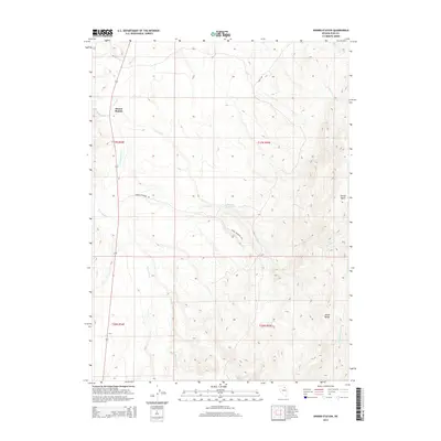
2014 Map of Dinner Station
USGS Topo · Published 2014About this map
Dinner Station sits as a lonely point of interest in this high-desert landscape of Elko County, marking a site deeply tied to the region's historic transportation routes. The terrain is defined by the prominent Adobe Range and the Dorsey Basin, where drainage patterns like Dorsey Cr and Mason Cr carve through the arid topography. This 2014 survey captures a sparsely populated ranching and grazing environment, where water management is critical to the local economy, as evidenced by the presence of Dorsey Reservoir and its namesake Dorsey Reservoir Rd. These features, along with seasonal flows from Sixteenmile Cr and Mud Spring Cr, illustrate the fundamental reliance on these intermittent water sources for land use in the Great Basin. The map provides a clear view of how public land survey boundaries and sections organize this open country.
Find a feature on this map
16 named features on this map. Tap any name to fly to it.
Don’t see what you’re looking for? This feature index may not catch every label — zoom into the map to look around manually.
Map Details
Editions of this 2014 Dinner Station Map
This is the sole edition of this map. No revisions or reprints were ever made.
Other maps of this area

1955 · Wells
USGS Topo · 1:250,000

1955 · Elko
USGS Topo · 1:250,000

1958 · Wells
USGS Topo · 1:250,000

1958 · Elko
USGS Topo · 1:250,000

1958 · Singletree Creek
USGS Topo · 1:24,000

1958 · Doby Summit
USGS Topo · 1:24,000

1961 · Wells
USGS Topo · 1:250,000

1962 · Elko
USGS Topo · 1:250,000

1962 · Kittridge Springs
USGS Topo · 1:24,000

1962 · Osino
USGS Topo · 1:24,000