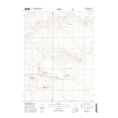
2016 Map of Dipper Spring
USGS Topo · Published 2016About this map
Pawnee National Grassland dominates the southwestern portion of this Weld County landscape, where the high plains meet the intricate drainage systems of the Colorado-Nebraska borderlands. The terrain is defined by a series of seasonal waterways and natural springs, most notably Dipper Spring and Antelope Spring, which have long served as vital water sources in this semi-arid region. These hydrological features are complemented by man-made improvements like Hackberry Reservoir, reflecting the area's agricultural and grazing history. The topography is marked by distinct landmarks such as Dipper Hill and the passage of Dipper Gap, providing a clear view of the natural corridors used for movement across the plains. A network of rural routes, including Co RD 64 and Co RD 157, trace the section lines, highlighting the systematic division of the land into the townships of the Weld and Logan County border.
Find a feature on this map
21 named features on this map. Tap any name to fly to it.
Don’t see what you’re looking for? This feature index may not catch every label — zoom into the map to look around manually.
Map Details
Editions of this 2016 Dipper Spring Map
This is the sole edition of this map. No revisions or reprints were ever made.
Other maps of this area

1954 · Sterling
USGS Topo · 1:250,000

1954 · Scottsbluff
USGS Topo · 1:250,000

1958 · Scottsbluff
USGS Topo · 1:250,000

1958 · Sterling
USGS Topo · 1:250,000

1972 · Potter SW
USGS Topo · 1:24,000

1972 · Kimball SE
USGS Topo · 1:24,000

1972 · Kimball SW
USGS Topo · 1:24,000

1977 · Dipper Spring
USGS Topo · 1:24,000
1977 · Battle Canyon
USGS Topo · 1:24,000

1977 · Avalo SE
USGS Topo · 1:24,000