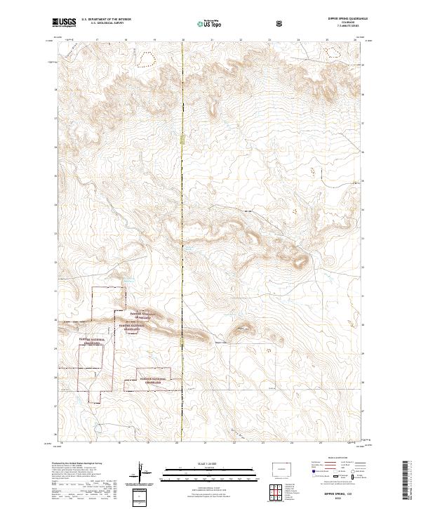
2022 Map of Dipper Spring
USGS Topo · Published 2022About this map
Pawnee National Grassland dominates the southern landscape of this 2022 survey, illustrating the conservation of the shortgrass prairie across the Weld and Logan county line. The terrain is characterized by a series of ephemeral watercourses and draws that carve through the high plains, including Sidney Draw in the northwest and Spring Draw near the southern border. These intermittent features, along with George Cr and Cedar Cr, define the drainage patterns of this sparsely populated ranching and grazing country.
Find a feature on this map
22 named features on this map. Tap any name to fly to it.
Don’t see what you’re looking for? This feature index may not catch every label — zoom into the map to look around manually.
Map Details
Editions of this 2022 Dipper Spring Map
This is the sole edition of this map. No revisions or reprints were ever made.
Other maps of this area

1954 · Sterling
USGS Topo · 1:250,000

1954 · Scottsbluff
USGS Topo · 1:250,000

1958 · Scottsbluff
USGS Topo · 1:250,000

1958 · Sterling
USGS Topo · 1:250,000

1972 · Potter SW
USGS Topo · 1:24,000

1972 · Kimball SE
USGS Topo · 1:24,000

1972 · Kimball SW
USGS Topo · 1:24,000

1977 · Dipper Spring
USGS Topo · 1:24,000
1977 · Battle Canyon
USGS Topo · 1:24,000

1977 · Avalo SE
USGS Topo · 1:24,000