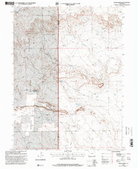
1997 Map of Dipper Spring
USGS Topo · Published 2000About this map
Pawnee National Grassland dominates this high plains landscape along the Weld and Logan County line, reflecting the federal land management patterns of the late 20th century. The settlement of Sidney sits in the northwestern corner, while the Cervi Ranch is located further south, highlighting the area's ongoing agricultural and ranching heritage. The terrain is defined by its intermittent water sources and landforms, including the prominent Dipper Hill and Dipper Gap.
Find a feature on this map
15 named features on this map. Tap any name to fly to it.
Don’t see what you’re looking for? This feature index may not catch every label — zoom into the map to look around manually.
Map Details
Editions of this 1997 Dipper Spring Map
This is the sole edition of this map. No revisions or reprints were ever made.
Other maps of this area

1954 · Sterling
USGS Topo · 1:250,000

1954 · Scottsbluff
USGS Topo · 1:250,000

1958 · Scottsbluff
USGS Topo · 1:250,000

1958 · Sterling
USGS Topo · 1:250,000

1972 · Potter SW
USGS Topo · 1:24,000

1972 · Kimball SE
USGS Topo · 1:24,000

1972 · Kimball SW
USGS Topo · 1:24,000

1977 · Dipper Spring
USGS Topo · 1:24,000
1977 · Battle Canyon
USGS Topo · 1:24,000

1977 · Avalo SE
USGS Topo · 1:24,000