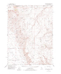
1961 Map of Disaster Peak
USGS Topo · Published 1977About this map
Kings River flows through the broad Kings River Valley in this northern Nevada cattle and mining landscape, captured during a 1961 field survey. The remote terrain is defined by the sharp rise of the Montana Mountains and The Granites, where high-altitude springs like Yellow Rose Sprs and Flat Creek Spr provided critical water sources for livestock. Human activity is concentrated around the Rio King Ranch and a series of isolated airstrips, including Airstrip 4307, which served as vital connections for this high-desert ranching country.
Find a feature on this map
67 named features on this map. Tap any name to fly to it.
Don’t see what you’re looking for? This feature index may not catch every label — zoom into the map to look around manually.
Map Details
Editions of this 1961 Disaster Peak Map
2 editions found

Other maps of this area

1882 · Paradise
USGS Topo · 1:250,000

1886 · Disaster
USGS Topo · 1:250,000

1893 · Paradise
USGS Topo · 1:250,000

1893 · Disaster
USGS Topo · 1:250,000

1954 · Vya
USGS Topo · 1:250,000

1955 · McDermitt
USGS Topo · 1:250,000

1955 · Jordan Valley
USGS Topo · 1:250,000

1955 · Adel
USGS Topo · 1:250,000

1957 · Adel
USGS Topo · 1:250,000

1957 · Jordan Valley
USGS Topo · 1:250,000