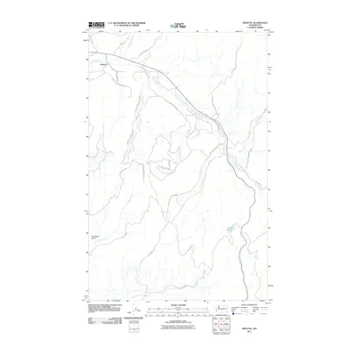
2011 Map of Disautel
USGS Topo · Published 2011About this map
Colville Indian Reservation land defines the landscape of this Washington quadrangle, where the settlement of Disautel sits at a crossroads near the headwaters of several drainages. The area is characterized by a complex network of Bureau of Indian Affairs (BIA) roads, such as BIA 1012 Rd and BIA 88 Rd, which provide access to the remote uplands and creek valleys. Water is a central feature of the terrain, with Omak Creek winding through the central portion of the map, fed by tributaries like Jim Creek and Trail Creek. To the southeast, Summit Lake provides a notable landmark amidst the high-elevation drainage patterns of Coyote Creek and Kartar Creek. The map documents a sparsely populated but vital section of Okanogan County, where the road system reflects the ongoing management and use of reservation lands for transportation and natural resources.
Find a feature on this map
23 named features on this map. Tap any name to fly to it.
Don’t see what you’re looking for? This feature index may not catch every label — zoom into the map to look around manually.
Map Details
Editions of this 2011 Disautel Map
This is the sole edition of this map. No revisions or reprints were ever made.
Other maps of this area

1950 · Boot Mtn
USGS Topo · 1:62,500

1950 · Alameda Flat
USGS Topo · 1:62,500

1952 · Alameda Flat
USGS Topo · 1:62,500

1952 · Disautel
USGS Topo · 1:62,500

1953 · Omak Lake
USGS Topo · 1:62,500

1954 · Okanogan
USGS Topo · 1:250,000

1958 · Okanogan
USGS Topo · 1:250,000
1980 · Camp Seven
USGS Topo · 1:24,000
1980 · Boot Mountain
USGS Topo · 1:24,000
1980 · Omak Mountain
USGS Topo · 1:24,000