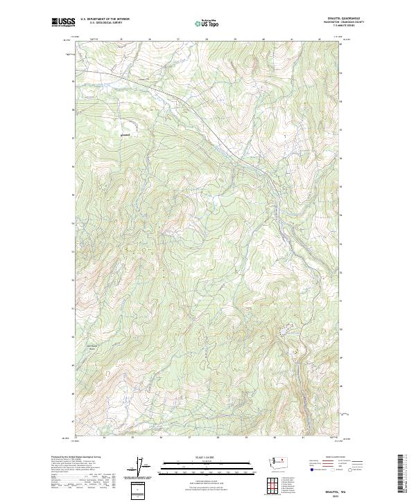
2023 Map of Disautel
USGS Topo · Published 2023About this map
Disautel sits within a complex network of forest roads and creek basins, serving as a focal point for this upland area of Okanogan County. The landscape is defined by its dramatic drainage systems, where Omak Creek and Swimpkin Creek converge near the northern boundary. To the south, the terrain descends into the Dan Nason Basin, a distinct geographical feature that implies the local importance of early cattle ranching or settlement patterns. The map detail highlights an extensive system of Bureau of Indian Affairs (BIA) routes, such as Bia RD 1011 and Bia RD 1133, which connect the scattered water sources and canyons.
Find a feature on this map
34 named features on this map. Tap any name to fly to it.
Don’t see what you’re looking for? This feature index may not catch every label — zoom into the map to look around manually.
Map Details
Editions of this 2023 Disautel Map
This is the sole edition of this map. No revisions or reprints were ever made.
Other maps of this area

1950 · Boot Mtn
USGS Topo · 1:62,500

1950 · Alameda Flat
USGS Topo · 1:62,500

1952 · Alameda Flat
USGS Topo · 1:62,500

1952 · Disautel
USGS Topo · 1:62,500

1953 · Omak Lake
USGS Topo · 1:62,500

1954 · Okanogan
USGS Topo · 1:250,000

1958 · Okanogan
USGS Topo · 1:250,000
1980 · Camp Seven
USGS Topo · 1:24,000
1980 · Boot Mountain
USGS Topo · 1:24,000
1980 · Omak Mountain
USGS Topo · 1:24,000