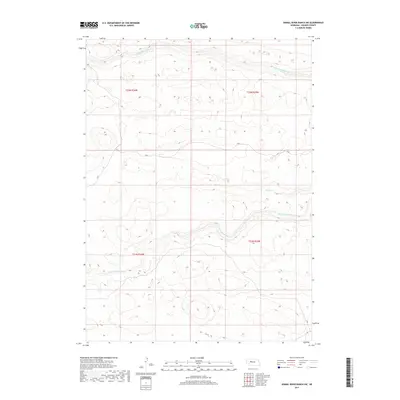
2017 Map of Dismal River Ranch SW
USGS Topo · Published 2017About this map
N Fork Dismal River and the S Fork Dismal River wind through the sandhills of Hooker County in this topographical study. This landscape is defined by the braided drainage patterns of these river forks, which create a distinct corridor of hydrologic activity amidst the surrounding high-elevation terrain. The presence of Spring Cr feeding into the south fork illustrates the natural groundwater discharge typical of this Nebraska region. While the map lacks formal town sites, the detailed Public Land Survey System grid including sections of t22n r34w, t22n r33w, t21n r34w, and t21n r33w provides the essential framework for researchers and landowners to pinpoint specific historical parcels and topographic changes within the Dismal River Ranch area.
Find a feature on this map
7 named features on this map. Tap any name to fly to it.
Don’t see what you’re looking for? This feature index may not catch every label — zoom into the map to look around manually.
Map Details
Editions of this 2017 Dismal River Ranch SW Map
This is the sole edition of this map. No revisions or reprints were ever made.
Other maps of this area

1947 · Dismal River Ranch
USGS Topo · 1:62,500

1948 · Carr Lake
USGS Topo · 1:62,500

1949 · Dismal River Ranch
USGS Topo · 1:62,500

1949 · Flats
USGS Topo · 1:62,500

1949 · Wright Valley
USGS Topo · 1:62,500

1950 · Flats
USGS Topo · 1:62,500

1950 · Carr Lake
USGS Topo · 1:62,500

1951 · Wright Valley
USGS Topo · 1:62,500

1954 · North Platte
USGS Topo · 1:250,000

1956 · North Platte
USGS Topo · 1:250,000