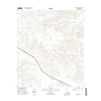
2016 Map of Divide Country
USGS Topo · Published 2016About this map
Divide Country is defined by a complex network of arid canyons and seasonal drainages in this high-plains region of Pecos County. The landscape is deeply carved by water-carved features such as Riffle Canyon and its smaller neighbor, Little Riffle Canyon, which dominate the northern portion of the quadrangle. These natural conduits for runoff feed into broader drainage patterns like Sixmile Draw and its northern and southern branches. Transportation in the mid-2010s was largely restricted to the corridor of Interstate 10, accompanied by the I 10 Svc Rd, while more remote access was provided by routes like Long Loop Rd. The map illustrates the hydrological importance of the Fourmile Draw and Lower Fourmile Draw, which serve as primary topographic markers in an area otherwise characterized by vast, open rangeland and rolling mesa terrain.
Find a feature on this map
11 named features on this map. Tap any name to fly to it.
Don’t see what you’re looking for? This feature index may not catch every label — zoom into the map to look around manually.
Map Details
Editions of this 2016 Divide Country Map
This is the sole edition of this map. No revisions or reprints were ever made.
Other maps of this area

1929 · Sheffield
USGS Topo · 1:125,000

1929 · Independence Draw Quadrangle
USGS Topo · 1:125,000

1954 · Fort Stockton
USGS Topo · 1:250,000

1954 · Sonora
USGS Topo · 1:250,000

1958 · Sonora
USGS Topo · 1:250,000

1958 · Fort Stockton
USGS Topo · 1:250,000

1967 · Twelvemile Camp
USGS Topo · 1:24,000

1967 · Divide Country
USGS Topo · 1:24,000

1967 · Sheffield NW
USGS Topo · 1:24,000

1967 · Deer Canyon
USGS Topo · 1:24,000