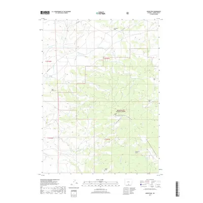
2017 Map of Divide Peak
USGS Topo · Published 2017About this map
Medicine Bow National Forest dominates this high-altitude landscape in Carbon County, where the hydrological spine of the continent dictates the flow of every drainage. The Continental Divide winds through the northern and eastern sections of the quadrangle, serving as the literal high point for the Continental Divide National Scenic Trail - Wyoming Portion. This rugged watershed is defined by the headwaters of several major tributaries, including N Fork Savery Cr and E Fork Savery Cr, which carve through deep timber and mountain parks.
Find a feature on this map
34 named features on this map. Tap any name to fly to it.
Don’t see what you’re looking for? This feature index may not catch every label — zoom into the map to look around manually.
Map Details
Editions of this 2017 Divide Peak Map
This is the sole edition of this map. No revisions or reprints were ever made.
Other maps of this area

1932 · Savery
USGS Topo · 1:96,000

1940 · Savery
USGS Topo · 1:125,000

1954 · Rawlins
USGS Topo · 1:250,000

1958 · Rawlins
USGS Topo · 1:250,000

1961 · Divide Peak
USGS Topo · 1:24,000

1961 · Middlewood Hill
USGS Topo · 1:24,000

1961 · Pine Grove Ranch
USGS Topo · 1:24,000

1961 · Bridger Peak
USGS Topo · 1:24,000

1961 · Jack Creek Reservoir
USGS Topo · 1:24,000
1961 · Singer Peak
USGS Topo · 1:24,000