
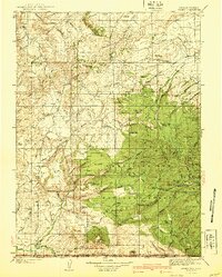
1940 Map of Savery
USGS Topo · Published 1940About this map
Savery sits at the southern edge of this survey, where the Snake River winds across the state line between Wyoming and Colorado. The terrain rises sharply to the north and east, defined by the Continental Divide and the wooded reaches of the Medicine Bow National Forest. This region reflects a landscape of early 20th-century resource management and high-country ranching, evidenced by scattered outposts like the Tullis settlement and the Jack Creek Ranger Sta. Surveyed between 1901 and 1932, the map documents the complex drainage systems of the Savery Creek watershed and the Sage Creek Basin. Notable high-altitude landmarks such as Bridger Peak, Battle Mtn, and Sheep Mtn overlook a network of trails and firelines, including the remote Rambler Ranger Sta near the mountain lakes.
Find a feature on this map
58 named features on this map. Tap any name to fly to it.
Don’t see what you’re looking for? This feature index may not catch every label — zoom into the map to look around manually.
Map Details
Editions of this 1940 Savery Map
2 editions found
Other maps of this area

1893 · Fort Steele
USGS Topo · 1:125,000

1911 · Hahns Peak
USGS Topo · 1:125,000

1913 · Hahns Peak
USGS Topo · 1:125,000

1916 · Craig
USGS Topo · 1:125,000

1932 · Savery
USGS Topo · 1:96,000

1939 · Saratoga
USGS Topo · 1:125,000

1954 · Rawlins
USGS Topo · 1:250,000

1954 · Craig
USGS Topo · 1:250,000

1955 · Overland Crossing
USGS Topo · 1:24,000

1956 · Bridger Pass
USGS Topo · 1:62,500