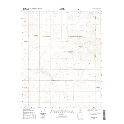
2013 Map of Divine Lake
USGS Topo · Published 2013About this map
Kiowa National Grassland dominates this high plains landscape, spanning the intersection of Union, Colfax, and Harding counties. The terrain is characterized by subtle volcanic and erosional landmarks, including the prominent Sugarloaf Mtn and Chateau Hill to the northwest. Water is a scarce and vital resource in this arid environment, marked by the eponymous Divine Lake and the seasonally sensitive Ramon Lakes.
Find a feature on this map
22 named features on this map. Tap any name to fly to it.
Don’t see what you’re looking for? This feature index may not catch every label — zoom into the map to look around manually.
Map Details
Editions of this 2013 Divine Lake Map
This is the sole edition of this map. No revisions or reprints were ever made.
Other maps of this area

1954 · Raton
USGS Topo · 1:250,000

1954 · Dalhart
USGS Topo · 1:250,000

1958 · Raton
USGS Topo · 1:250,000

1958 · Dalhart
USGS Topo · 1:250,000

1962 · Dalhart
USGS Topo · 1:250,000
1973 · Valencia Spring
USGS Topo · 1:24,000
1974 · Kansas Valley
USGS Topo · 1:24,000

1974 · Farley
USGS Topo · 1:24,000
1974 · Mills East
USGS Topo · 1:24,000

1974 · Spear Hills
USGS Topo · 1:24,000