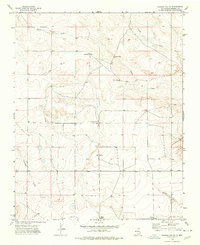
1974 Map of Kansas Valley
USGS Topo · Published 1977About this map
Kansas Valley defines this portion of Harding County, where the high plains are carved by a network of seasonal watercourses and drainage basins. During this mid-1970s survey, the landscape was primarily organized around livestock management, evidenced by the strategic placement of family-named water sources like Jackson Windmill, Nugen Windmill, and Slusher Windmill. The terrain is characterized by broad draws and creek beds, including Spear Draw and Carrizo Creek, which provided essential natural corridors in this arid environment. The map details a ranching economy where infrastructure is sparse but vital, noting improvements such as the Spear Tank and West Spear Windmill that sustained operations across the open range. This topographical study captures the intersection of natural hydrology and human ranching heritage in northeastern New Mexico.
Find a feature on this map
12 named features on this map. Tap any name to fly to it.
Don’t see what you’re looking for? This feature index may not catch every label — zoom into the map to look around manually.
Map Details
Editions of this 1974 Kansas Valley Map
This is the sole edition of this map. No revisions or reprints were ever made.
Other maps of this area

1954 · Santa Fe
USGS Topo · 1:250,000

1954 · Raton
USGS Topo · 1:250,000

1954 · Tucumcari
USGS Topo · 1:250,000

1954 · Dalhart
USGS Topo · 1:250,000

1958 · Raton
USGS Topo · 1:250,000

1958 · Santa Fe
USGS Topo · 1:250,000

1958 · Tucumcari
USGS Topo · 1:250,000

1958 · Dalhart
USGS Topo · 1:250,000

1962 · Dalhart
USGS Topo · 1:250,000

1973 · Sabino
USGS Topo · 1:24,000