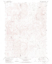
1980 Map of Division Peak
USGS Topo · Published 1980About this map
Sheep Peaks and Division Peak dominate this high-desert terrain along the Washoe Co Humboldt Co line. The 1980 survey illustrates a landscape defined by seasonal water sources and rugged topography, where numerous water points like Mc Carty Spring, Donnelly Spring, and Pipeline Spring provided critical resources in an arid environment. Human activity is sparse but evident through a network of infrastructure, including a Gaging Station and a Prospect tucked into the hills south of Donnelly Flat. The map traces the movement of early travel through the winding Leadville Canyon and Razor Canyon, as well as the path of the Barley Road. This record of the Nevada interior shows how surveying and monitoring efforts, such as those at Willow Creek and Little Smoky Creek, documented the hydrology and mineral potential of this remote corridor.
Find a feature on this map
19 named features on this map. Tap any name to fly to it.
Don’t see what you’re looking for? This feature index may not catch every label — zoom into the map to look around manually.
Map Details
Editions of this 1980 Division Peak Map
This is the sole edition of this map. No revisions or reprints were ever made.
Other maps of this area

1886 · Granite Range
USGS Topo · 1:250,000

1889 · Long Valley
USGS Topo · 1:250,000

1894 · Granite Range
USGS Topo · 1:250,000

1954 · Vya
USGS Topo · 1:250,000

1955 · Lovelock
USGS Topo · 1:250,000

1958 · Vya
USGS Topo · 1:250,000

1959 · Lovelock
USGS Topo · 1:250,000

1962 · Vya
USGS Topo · 1:250,000

1979 · Butte Spring
USGS Topo · 1:24,000

1980 · Melody Mountain
USGS Topo · 1:24,000