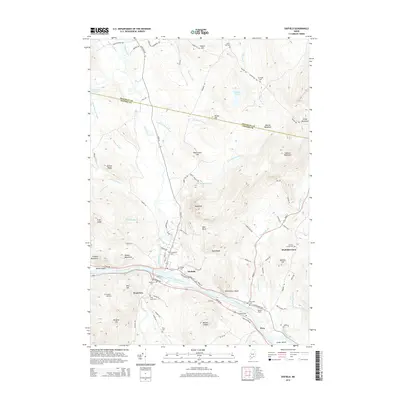
2014 Map of Dixfield
USGS Topo · Published 2014About this map
The Androscoggin River flows through the southern portion of this region, joined by the Webb River which travels south from The Falls. This Oxford County terrain is defined by its numerous family-named peaks and ridges, including Masterman Hill, Potter Hill, and Kidder Mountain. The settlement of Dixfield serves as a central hub, surrounded by smaller communities such as West Peru and Dixfield Center.
Find a feature on this map
101 named features on this map. Tap any name to fly to it.
Don’t see what you’re looking for? This feature index may not catch every label — zoom into the map to look around manually.
Map Details
Editions of this 2014 Dixfield Map
This is the sole edition of this map. No revisions or reprints were ever made.
Other maps of this area

1911 · Bryant Pond
USGS Topo · 1:62,500

1911 · Buckfield
USGS Topo · 1:62,500

1913 · Buckfield
USGS Topo · 1:62,500

1914 · Bryant Pond
USGS Topo · 1:62,500

1926 · Dixfield
USGS Topo · 1:62,500

1927 · Rumford
USGS Topo · 1:48,000

1929 · Dixfield
USGS Topo · 1:62,500

1930 · Rumford
USGS Topo · 1:62,500

1942 · Buckfield
USGS Topo · 1:62,500

1942 · Bryant Pond
USGS Topo · 1:62,500