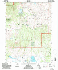
1993 Map of Dixie Peak
USGS Topo · Published 1997About this map
Dixie Valley anchors this high-elevation landscape in the northeast corner of Lassen County, where the southern reaches of the Modoc National Forest meet the alluvial flats of the Great Basin. The 1993 field check reveals a terrain heavily managed for water and wildlife, featuring numerous engineered catchments such as Hooper Flat Reservoir, Wagontire Reservoir, and Bald Mtn Reservoir. The presence of the Dixie Ranch and a Campsite at Hooper Flat suggests a continued reliance on this land for both ranching and seasonal recreation.
Find a feature on this map
39 named features on this map. Tap any name to fly to it.
Don’t see what you’re looking for? This feature index may not catch every label — zoom into the map to look around manually.
Map Details
Editions of this 1993 Dixie Peak Map
This is the sole edition of this map. No revisions or reprints were ever made.
Other maps of this area

1886 · Alturas
USGS Topo · 1:250,000

1886 · Honey Lake
USGS Topo · 1:250,000

1886 · Lassen Peak
USGS Topo · 1:250,000

1886 · Modoc Lava Bed
USGS Topo · 1:250,000

1891 · Honey Lake
USGS Topo · 1:250,000

1892 · Modoc Lava-Bed
USGS Topo · 1:250,000

1892 · Lassen Peak
USGS Topo · 1:250,000

1892 · Alturas
USGS Topo · 1:250,000

1893 · Honey Lake
USGS Topo · 1:250,000

1894 · Lassen Peak
USGS Topo · 1:250,000