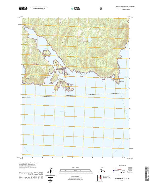
2021 Map of Dixon Entrance C-1 NE
USGS Topo · Published 2021About this map
Nichols Bay carves deeply into the southern tip of the Alexander Archipelago in this maritime survey, where the terrestrial wilderness of the Tongass National Forest meets the open Pacific waters. The coastline is defined by sharp topographic transitions, from the sheer face of Huaji Cliff to the prominent heights of Intunidli Hill and Intun Cone. This area serves as a critical nautical gateway, marking the confluence of Clarence Strait and the Dixon Entrance international waterway. The map captures a landscape almost entirely defined by its shoreline features, including isolated landforms like Bean Island and navigational landmarks such as Point Nunez and Cape Chacon. The lack of inland development emphasizes the maritime nature of this southern Alaskan boundary, where the forest gives way to the sea at Surf Point and Brown Bear Rock.
Find a feature on this map
18 named features on this map. Tap any name to fly to it.
Don’t see what you’re looking for? This feature index may not catch every label — zoom into the map to look around manually.
Map Details
Editions of this 2021 Dixon Entrance C-1 NE Map
This is the sole edition of this map. No revisions or reprints were ever made.
Other maps of this area

1948 · Prince Rupert D-6
USGS Topo · 1:63,360

1948 · Dixon Entrance C-1
USGS Topo · 1:63,360

1948 · Dixon Entrance D-1
USGS Topo · 1:63,360

1951 · Prince Rupert
USGS Topo · 1:250,000

1951 · Dixon Entrance
USGS Topo · 1:250,000

1951 · Prince Rupert D-6
USGS Topo · 1:63,360

1959 · Dixon Entrance
USGS Topo · 1:250,000

1959 · Prince Rupert
USGS Topo · 1:250,000

1964 · Prince Rupert
USGS Topo · 1:250,000
1994 · Dixon Entrance D-1
USGS Topo · 1:63,360