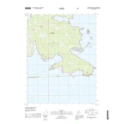
2017 Map of Dixon Entrance C-3 NE
USGS Topo · Published 2017About this map
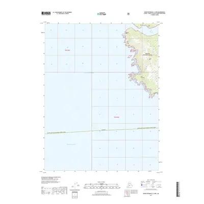
Cape Muzon defines the southern tip of Dall Island, marking a significant landform within the Alexander Archipelago at the edge of the Gulf of Alaska. This portion of the Tongass National Forest is characterized by a deeply indented coastline where the sea reaches into the land via McLeod Bay, Liscome Bay, and Wolk Harbor. These natural harbors and sheltered bights like Chickwan Bight have historically provided refuge in the often-turbulent waters of the Pacific Ocean. The map reveals a landscape dominated by steep coastal topography and intricate island groups, including the Datzkoo Islands and Daykoo Islands tucked near the Kaigani Strait. This 2017 survey documents the precise shoreline and elevations of this remote wilderness area within the Prince of Wales-Hyder Census Area.
Find a feature on this map
23 named features on this map. Tap any name to fly to it.
Don’t see what you’re looking for? This feature index may not catch every label — zoom into the map to look around manually.
Map Details
Editions of this 2017 Dixon Entrance C-3 NE Map
This is the sole edition of this map. No revisions or reprints were ever made.
Other maps of this area

1948 · Dixon Entrance D-2
USGS Topo · 1:63,360
1948 · Dixon Entrance C-3
USGS Topo · 1:63,360

1948 · Dixon Entrance D-3
USGS Topo · 1:63,360

1951 · Dixon Entrance
USGS Topo · 1:250,000

1951 · Dixon Entrance D-3
USGS Topo · 1:63,360

1951 · Dixon Entrance D-2
USGS Topo · 1:63,360

1959 · Dixon Entrance
USGS Topo · 1:250,000
1994 · Dixon Entrance C-3
USGS Topo · 1:63,360
2017 · Dixon Entrance D-2 SW
USGS Topo · 1:25,000
2017 · Dixon Entrance C-3 NW
USGS Topo · 1:25,000