1951 Map of Dixon Entrance D-3
USGS Topo · Published 1963About this map
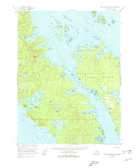
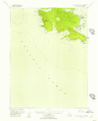
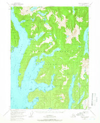
The coastal village site of Howkan sits along the Howkan Narrows on Long Island, a central landmark in this 1951 topographic study of the Alexander Archipelago. This remote maritime landscape is characterized by its complex network of waterways, including Kaigani Strait and Tlevak Strait, which served as vital corridors for the region's fishing and canning industries. A Cannery is positioned near Rose Point at the northern mouth of Rose Inlet, marking the industrial footprint of the mid-century era.
Find a feature on this map
62 named features on this map. Tap any name to fly to it.
Don’t see what you’re looking for? This feature index may not catch every label — zoom into the map to look around manually.
Map Details
Editions of this 1951 Dixon Entrance D-3 Map
2 editions found

Other maps of this area

1948 · Craig A-4
USGS Topo · 1:63,360

1948 · Dixon Entrance D-2
USGS Topo · 1:63,360
1948 · Dixon Entrance C-3
USGS Topo · 1:63,360

1948 · Dixon Entrance D-4
USGS Topo · 1:63,360

1948 · Dixon Entrance D-3
USGS Topo · 1:63,360

1948 · Craig A-3
USGS Topo · 1:63,360

1948 · Craig A-2
USGS Topo · 1:63,360

1951 · Dixon Entrance
USGS Topo · 1:250,000

1951 · Dixon Entrance D-2
USGS Topo · 1:63,360
1951 · Craig A-2
USGS Topo · 1:63,360