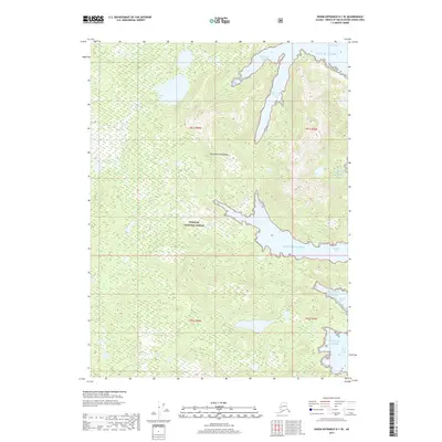
2017 Map of Dixon Entrance D-1 SE
USGS Topo · Published 2017About this map
Tongass National Forest dominates this coastal portion of the Alexander Archipelago, where the land is defined by deeply recessed saltwater inlets and complex shorelines. The topography is dominated by the sprawling reaches of Kendrick Bay, which branches into the Short Arm Kendrick Bay and the elongated South Arm Kendrick Bay. Further south, the narrow McLean Arm cuts deep into the timbered interior, illustrating the classic glaciated fjord landscape of Southeast Alaska. This 2017 survey by the U.S. Geological Survey details a region nearly devoid of human infrastructure, focusing instead on the natural interface between the Gulf of Alaska and the steep, forested terrain. Small coastal features like Mallard Bay and Stone Rock Bay provide specific points of reference for maritime navigation and historical shoreline study within this protected wilderness area.
Find a feature on this map
13 named features on this map. Tap any name to fly to it.
Don’t see what you’re looking for? This feature index may not catch every label — zoom into the map to look around manually.
Map Details
Editions of this 2017 Dixon Entrance D-1 SE Map
This is the sole edition of this map. No revisions or reprints were ever made.
Other maps of this area

1948 · Prince Rupert D-6
USGS Topo · 1:63,360

1948 · Dixon Entrance C-1
USGS Topo · 1:63,360

1948 · Dixon Entrance D-1
USGS Topo · 1:63,360

1951 · Prince Rupert
USGS Topo · 1:250,000

1951 · Dixon Entrance
USGS Topo · 1:250,000

1951 · Prince Rupert D-6
USGS Topo · 1:63,360

1959 · Dixon Entrance
USGS Topo · 1:250,000

1959 · Prince Rupert
USGS Topo · 1:250,000

1964 · Prince Rupert
USGS Topo · 1:250,000
1994 · Dixon Entrance D-1
USGS Topo · 1:63,360