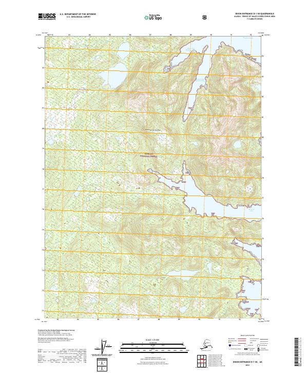
2021 Map of Dixon Entrance D-1 SE
USGS Topo · Published 2021About this map
Alexander Archipelago islands define the maritime character of this remote coastal landscape within the Tongass National Forest. The geography is dominated by deep glacial incisions into the shoreline, most notably the long reaches of Kendrick Bay and its northern and southern extensions, Short Arm Kendrick Bay and South Arm Kendrick Bay. To the south, the protected waters of McLean Arm cut deeply into the landmass, providing a natural harbor characteristic of the Alaskan Panhandle's complex coastline. Produced by the U.S. Geological Survey, this topographic record documents the intersection of vast temperate rainforests and the Pacific inlets that historically served as the primary transit corridors for the region's early logging and fishing industries.
Find a feature on this map
11 named features on this map. Tap any name to fly to it.
Don’t see what you’re looking for? This feature index may not catch every label — zoom into the map to look around manually.
Map Details
Editions of this 2021 Dixon Entrance D-1 SE Map
This is the sole edition of this map. No revisions or reprints were ever made.
Other maps of this area

1948 · Prince Rupert D-6
USGS Topo · 1:63,360

1948 · Dixon Entrance C-1
USGS Topo · 1:63,360

1948 · Dixon Entrance D-1
USGS Topo · 1:63,360

1951 · Prince Rupert
USGS Topo · 1:250,000

1951 · Dixon Entrance
USGS Topo · 1:250,000

1951 · Prince Rupert D-6
USGS Topo · 1:63,360

1959 · Dixon Entrance
USGS Topo · 1:250,000

1959 · Prince Rupert
USGS Topo · 1:250,000

1964 · Prince Rupert
USGS Topo · 1:250,000
1994 · Dixon Entrance D-1
USGS Topo · 1:63,360