
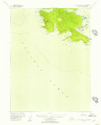
1951 Map of Dixon Entrance D-2
USGS Topo · Published 1964About this map
Klinkwan sits along the shoreline of Prince of Wales Island, serving as a central point of settlement in this 1951 survey of Southeast Alaska's maritime landscape. This region, entirely within the Tongass National Forest, is defined by a dense network of waterways and islands including Long Island and the scattered Barrier Islands. The mapping reflects a period when marine navigation and coastal resources dictated the footprint of human activity, with numerous named points and coves like Klinkwan Cove and Tah Bay indicating localized maritime knowledge. The intricate geometry of Ship Island Passage and Eureka Channel underscores the complexity of the coastal environment during the mid-twentieth century, prior to more modern development. Researchers can trace the exact topography of the shoreline from Kassa Island to the mouth of Klakas Inlet as it was recorded shortly after the war.
Find a feature on this map
67 named features on this map. Tap any name to fly to it.
Don’t see what you’re looking for? This feature index may not catch every label — zoom into the map to look around manually.
Map Details
Editions of this 1951 Dixon Entrance D-2 Map
This is the sole edition of this map. No revisions or reprints were ever made.
Other maps of this area

1948 · Dixon Entrance D-2
USGS Topo · 1:63,360
1948 · Dixon Entrance C-3
USGS Topo · 1:63,360

1948 · Dixon Entrance C-1
USGS Topo · 1:63,360

1948 · Craig A-1
USGS Topo · 1:63,360

1948 · Dixon Entrance D-1
USGS Topo · 1:63,360

1948 · Dixon Entrance D-3
USGS Topo · 1:63,360

1948 · Craig A-3
USGS Topo · 1:63,360

1948 · Craig A-2
USGS Topo · 1:63,360

1951 · Dixon Entrance
USGS Topo · 1:250,000

1951 · Dixon Entrance D-3
USGS Topo · 1:63,360