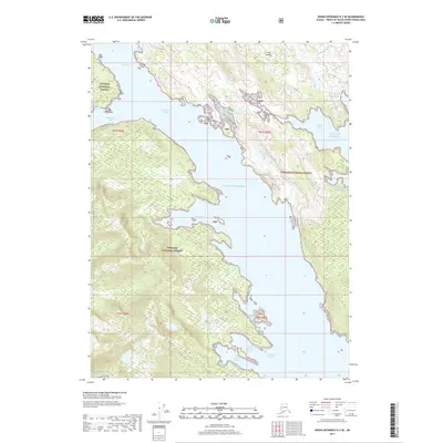
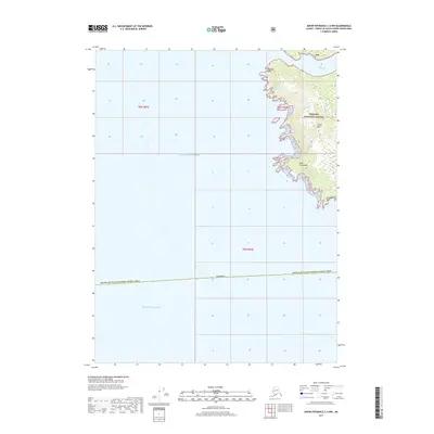
2017 Map of Dixon Entrance D-3 SE
USGS Topo · Published 2017About this map
Kaigani Strait divides the dense rainforests and intricate shorelines of the Tongass National Forest in this coastal Alaskan survey. The maritime geography is defined by a series of deep inlets and protected coves, most notably the dual anchorages of North Kaigani Harbor and South Kaigani Harbor. Further north, the waterway narrows at Howkan Narrows, a passage flanked by Mission Cove and the hazardous Howkan Reef. The landscape is largely undeveloped, showing the primitive character of the Alexander Archipelago where Lake Seclusion and Pond Bay sit tucked away from the open Gulf of Alaska. Navigational landmarks like Dix Point and the Bay Islands within American Bay illustrate the critical reliance on sea-based transport and natural harbors in this maritime wilderness.
Find a feature on this map
22 named features on this map. Tap any name to fly to it.
Don’t see what you’re looking for? This feature index may not catch every label — zoom into the map to look around manually.
Map Details
Editions of this 2017 Dixon Entrance D-3 SE Map
This is the sole edition of this map. No revisions or reprints were ever made.
Other maps of this area

1948 · Dixon Entrance D-2
USGS Topo · 1:63,360
1948 · Dixon Entrance C-3
USGS Topo · 1:63,360

1948 · Dixon Entrance D-3
USGS Topo · 1:63,360

1951 · Dixon Entrance
USGS Topo · 1:250,000

1951 · Dixon Entrance D-3
USGS Topo · 1:63,360

1951 · Dixon Entrance D-2
USGS Topo · 1:63,360

1959 · Dixon Entrance
USGS Topo · 1:250,000
1994 · Dixon Entrance C-3
USGS Topo · 1:63,360
2017 · Dixon Entrance D-2 SW
USGS Topo · 1:25,000
2017 · Dixon Entrance C-3 NW
USGS Topo · 1:25,000