2021 Map of Dixon
USGS Topo · Published 2021About this map
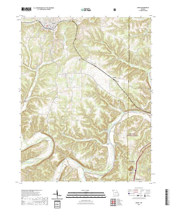
Dixon serves as the primary municipal hub in this northern Pulaski County landscape, where the street grid of W 5th St and Chestnut St meets the rail corridor. The terrain south of town is defined by the winding course of the Gasconade River and the Big Piney River, which converge near Boiling Spring. This riverine environment is marked by significant topographic relief, including Portuguese Point and several hollows like Mud Cave Hollow and Hickory Hollow. Much of the eastern and southern portions of the map are protected within the Mark Twain National Forest. Local history is preserved at sites like Egan Cem and Goodall Cem, while the southern reaches reveal geological features such as Conical Sink and Slaughter Sink. The map traces the shift from the organized town blocks of Dixon to the more dispersed settlements of Franks and Powellville near the Phelps County line.
Find a feature on this map
79 named features on this map. Tap any name to fly to it.
Don’t see what you’re looking for? This feature index may not catch every label — zoom into the map to look around manually.
Map Details
Editions of this 2021 Dixon Map
This is the sole edition of this map. No revisions or reprints were ever made.