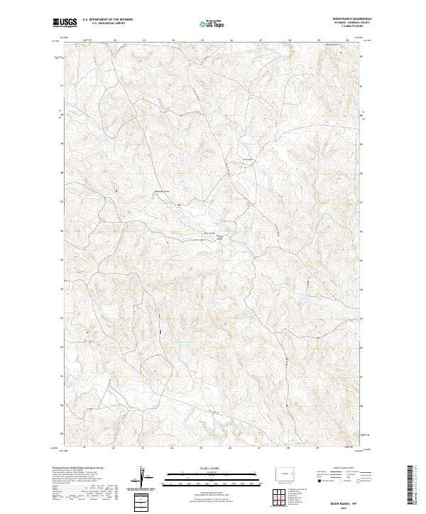
2021 Map of Dixon Ranch
USGS Topo · Published 2021About this map
Dixon Ranch serves as the primary landmark in this ranching landscape of Niobrara County, where the topography is defined by a complex network of seasonal drainages and draws. The map illustrates a high plains environment reliant on water management, centered around the Thompson Number 1 Reservoir and the winding course of Dogie Cr. Transport through the area is limited to established rural routes like N Lance Creek Rd and Cow Creek Rd, which follow the natural contours of the land. The numerous named drainage features, such as Hooligan Draw, Jolly Draw, and Timber Draw, highlight the specific local nomenclature used by landholders to navigate this dissected terrain. These features, along with S Snyder Cr and Clayton Draw, provide a detailed look at the hydrology of the Wyoming plains during the early 21st century.
Find a feature on this map
16 named features on this map. Tap any name to fly to it.
Don’t see what you’re looking for? This feature index may not catch every label — zoom into the map to look around manually.
Map Details
Editions of this 2021 Dixon Ranch Map
This is the sole edition of this map. No revisions or reprints were ever made.
Other maps of this area

1955 · Newcastle
USGS Topo · 1:250,000

1958 · Newcastle
USGS Topo · 1:250,000

1981 · Calf Draw
USGS Topo · 1:24,000

1981 · Horseshoe Bend
USGS Topo · 1:24,000

1981 · Mercer Draw
USGS Topo · 1:24,000

1981 · Dixon Ranch
USGS Topo · 1:24,000

1981 · Lance Creek NW
USGS Topo · 1:24,000
1981 · Boggy Reservoir
USGS Topo · 1:24,000
1981 · Funny Rock
USGS Topo · 1:24,000

1981 · Garland Draw
USGS Topo · 1:24,000