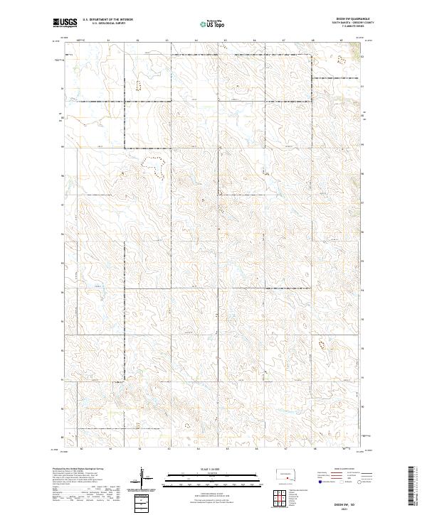
2021 Map of Dixon SW
USGS Topo · Published 2021About this map
Lone Tree Cr and S Fork Whetstone Cr drain this upland portion of Gregory County, where the landscape is defined by a rigorous grid of section lines and range boundaries. The area is divided among several townships, including t98n r73w and t99n r72w, reflecting the structured agricultural settlement of South Dakota's south-central plains. The map reveals a transition in drainage patterns, with Bull Cr and its tributary, E Br Bull Cr, carving modest draws through the prairie. While no major towns are shown on this specific quadrangle, the dense network of local routes like Co Rd 19 and Co Rd 17 illustrates the reach of the county road system serving isolated farmsteads. This 2021 survey provides a clear look at the contemporary rural infrastructure and the persistent natural drainage features that have dictated land use in the region for generations.
Find a feature on this map
34 named features on this map. Tap any name to fly to it.
Don’t see what you’re looking for? This feature index may not catch every label — zoom into the map to look around manually.
Map Details
Editions of this 2021 Dixon SW Map
This is the sole edition of this map. No revisions or reprints were ever made.
Other maps of this area

1955 · Mitchell
USGS Topo · 1:250,000

1959 · Mitchell
USGS Topo · 1:250,000

1964 · Gregory
USGS Topo · 1:24,000

1964 · Dallas
USGS Topo · 1:24,000
1964 · Burke
USGS Topo · 1:24,000

1971 · Dixon SW
USGS Topo · 1:24,000

1971 · Rattlesnake Butte East
USGS Topo · 1:24,000

1971 · Dixon
USGS Topo · 1:24,000

1971 · Colome SE
USGS Topo · 1:24,000

1971 · Dixon SE
USGS Topo · 1:24,000