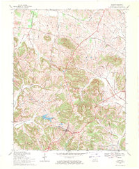
1969 Map of Dixon
USGS Topo · Published 1971About this map
Dixon serves as the focal point of this Webster County landscape, situated at the junction of several regional routes leading toward Providence and Henderson. The town's civic character is defined by the Dixon Lookout Tower and its proximity to City Lake and the larger Walker Lake to the west. The surrounding countryside reveals a dense network of local history, where small communities like Tilden and Wanamaker are anchored by landmarks such as the Wanamaker School and Fairview School.
Find a feature on this map
31 named features on this map. Tap any name to fly to it.
Don’t see what you’re looking for? This feature index may not catch every label — zoom into the map to look around manually.
Map Details
Editions of this 1969 Dixon Map
This is the sole edition of this map. No revisions or reprints were ever made.
Other maps of this area

1906 · Sebree
USGS Topo · 1:62,500

1907 · Earlington
USGS Topo · 1:48,000

1907 · Morganfield
USGS Topo · 1:62,500

1909 · Earlington
USGS Topo · 1:62,500

1909 · Providence
USGS Topo · 1:62,500

1949 · Sebree
USGS Topo · 1:24,000

1949 · Poole
USGS Topo · 1:24,000

1949 · Robards
USGS Topo · 1:24,000

1951 · Dixon
USGS Topo · 1:24,000

1951 · Poole
USGS Topo · 1:24,000