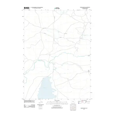
2012 Map of Dodge Ranch
USGS Topo · Published 2012About this map
The Laramie River winds through this section of Albany County, defining a landscape of high-plains ranching and water management. Large-scale irrigation and cattle operations are evident through named properties such as Dodge Ranch, Kennedy Ranch, and Palmer Ranch, which are connected by a network of rural routes including Palmer Canyon Rd and Tunnel Rd. The presence of the South Side Ditch and the expansive Wheatland Reservoir Number 2 highlights the critical role of water infrastructure in sustaining this environment. Terrain features like Bull Camp Peak and Long Canyon provide natural landmarks in a region where the topography is shaped by both the river valley and the foothills. This 2012 survey captures the modern configuration of these historic ranching lands, illustrating how natural watercourses like Dodge Cr and Duck Cr are supplemented by man-made catchments like Glade Number 2 Reservoir.
Find a feature on this map
15 named features on this map. Tap any name to fly to it.
Don’t see what you’re looking for? This feature index may not catch every label — zoom into the map to look around manually.
Map Details
Editions of this 2012 Dodge Ranch Map
This is the sole edition of this map. No revisions or reprints were ever made.
Other maps of this area

1954 · Torrington
USGS Topo · 1:250,000

1954 · Cheyenne
USGS Topo · 1:250,000

1955 · Mc Gill Lakes
USGS Topo · 1:24,000

1955 · Dodge Ranch
USGS Topo · 1:24,000

1955 · Bluegrass Wells
USGS Topo · 1:24,000

1955 · Ayres Spring
USGS Topo · 1:24,000

1955 · Guide Rock
USGS Topo · 1:24,000

1955 · Bull Camp Peak
USGS Topo · 1:24,000

1958 · Cheyenne
USGS Topo · 1:250,000

1958 · Torrington
USGS Topo · 1:250,000