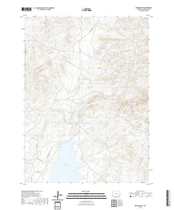
2021 Map of Dodge Ranch
USGS Topo · Published 2021About this map
Wheatland Reservoir Number Two dominates the southern landscape of this 2021 survey, serving as a critical water management feature in Albany County. The Laramie River meanders across the central terrain, supported by a network of irrigation and storage infrastructure including the S Side Ditch and Glade Number 2 Reservoir. This high-plains region is defined by the legacy of ranching, anchored by the Dodge Ranch near the river's bend. To the north, the terrain becomes more varied as it rises toward Duck Creek and Kennedy Reservoir Number 1, while Long Canyon marks the eastern edge. Local transportation is facilitated by thoroughfares like Palmer Canyon Rd and newer residential paths such as Hail Stone Dr and Stillwater Trl, reflecting the intersection of traditional agricultural land use and more contemporary rural development.
Find a feature on this map
21 named features on this map. Tap any name to fly to it.
Don’t see what you’re looking for? This feature index may not catch every label — zoom into the map to look around manually.
Map Details
Editions of this 2021 Dodge Ranch Map
This is the sole edition of this map. No revisions or reprints were ever made.
Other maps of this area

1954 · Torrington
USGS Topo · 1:250,000

1954 · Cheyenne
USGS Topo · 1:250,000

1955 · Mc Gill Lakes
USGS Topo · 1:24,000

1955 · Dodge Ranch
USGS Topo · 1:24,000

1955 · Bluegrass Wells
USGS Topo · 1:24,000

1955 · Ayres Spring
USGS Topo · 1:24,000

1955 · Guide Rock
USGS Topo · 1:24,000

1955 · Bull Camp Peak
USGS Topo · 1:24,000

1958 · Cheyenne
USGS Topo · 1:250,000

1958 · Torrington
USGS Topo · 1:250,000