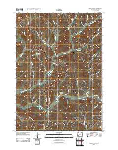
2011 Map of Dodson Butte
USGS Topo · Published 2011About this map
Dodson Butte dominates the northwestern horizon of this Douglas County landscape, where the drainage networks of North Myrtle Creek and South Myrtle Creek carve through the terrain. The map captures a sophisticated network of resource management and rural infrastructure, including Eleanor Reservoir and several Bureau of Land Management routes like BLM 29-4-17.0 Rd. Genealogists and local historians will find the location of Bryant Cemetery particularly significant, situated near School Hollow. The map also documents named geographic features such as Sanderson Gulch, Fisher Gulch, and the notable Cavitt Falls on the southern edge. This 2011 survey provides a clear view of the complex logging and access roads, such as Strode Canyon Rd and Days Creek Cutoff, that define the modern human footprint in this part of the Oregon Cascades.
Find a feature on this map
49 named features on this map. Tap any name to fly to it.
Don’t see what you’re looking for? This feature index may not catch every label — zoom into the map to look around manually.
Map Details
Editions of this 2011 Dodson Butte Map
This is the sole edition of this map. No revisions or reprints were ever made.
Other maps of this area

1897 · Roseburg
USGS Topo · 1:125,000

1900 · Roseburg
USGS Topo · 1:125,000

1904 · Riddle
USGS Topo · 1:125,000

1954 · Dixonville
USGS Topo · 1:62,500

1954 · Days Creek
USGS Topo · 1:62,500

1954 · Canyonville
USGS Topo · 1:62,500

1955 · Roseburg
USGS Topo · 1:62,500

1955 · Medford
USGS Topo · 1:250,000

1957 · Medford
USGS Topo · 1:250,000

1958 · Medford
USGS Topo · 1:250,000