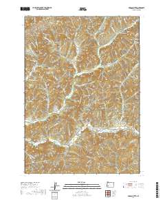
2020 Map of Dodson Butte
USGS Topo · Published 2020About this map
Dodson Butte towers over this section of Douglas County, where the landscape is defined by the branching drainages of North Myrtle Creek and South Myrtle Creek. The terrain is etched with numerous named gulches and hollows, including Sanderson Gulch, School Hollow, and Stinger Gulch, reflecting a history of small-scale naming by early residents and land managers. A network of logging routes and forest access paths, such as Old Logging Rd and W Frozen Creek Rd, crisscrosses the ridges between water bodies like Eleanor Reservoir. The presence of the Bryant Cem near S Myrtle Cr provides a specific point of interest for those tracing family history in this corner of the Pacific Northwest, marking a quiet legacy of settlement amidst the timberlands.
Find a feature on this map
74 named features on this map. Tap any name to fly to it.
Don’t see what you’re looking for? This feature index may not catch every label — zoom into the map to look around manually.
Map Details
Editions of this 2020 Dodson Butte Map
This is the sole edition of this map. No revisions or reprints were ever made.
Other maps of this area

1897 · Roseburg
USGS Topo · 1:125,000

1900 · Roseburg
USGS Topo · 1:125,000

1904 · Riddle
USGS Topo · 1:125,000

1954 · Dixonville
USGS Topo · 1:62,500

1954 · Days Creek
USGS Topo · 1:62,500

1954 · Canyonville
USGS Topo · 1:62,500

1955 · Roseburg
USGS Topo · 1:62,500

1955 · Medford
USGS Topo · 1:250,000

1957 · Medford
USGS Topo · 1:250,000

1958 · Medford
USGS Topo · 1:250,000