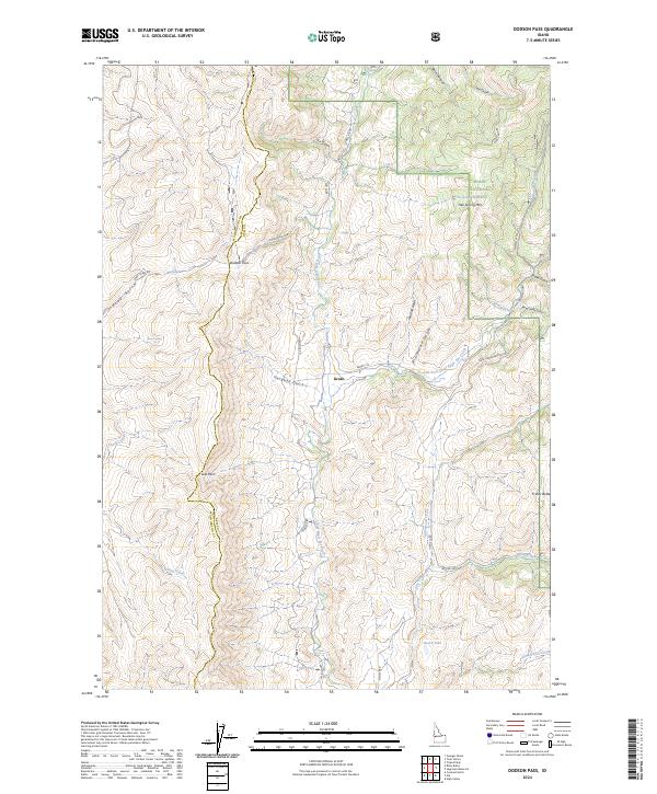
2024 Map of Dodson Pass
USGS Topo · Published 2024About this map
The settlement of Gross sits at the heart of this landscape, situated along the drainage of Vaughan Gulch within the Boise National Forest. The map illustrates a rugged network of ridges and drainages straddling the boundary between Washington and Gem counties, defined by high points like Tree Spring Mtn and Friday Butte. This terrain is navigated by a series of primitive routes including Dodson Pass Rd and Hancock Rd, which serve the various springs and gulches that feed into larger systems like Chief Eagle Eye Creek.
Find a feature on this map
40 named features on this map. Tap any name to fly to it.
Don’t see what you’re looking for? This feature index may not catch every label — zoom into the map to look around manually.
Map Details
Editions of this 2024 Dodson Pass Map
This is the sole edition of this map. No revisions or reprints were ever made.
Other maps of this area

1894 · Squaw Creek
USGS Topo · 1:125,000

1953 · Smiths Ferry
USGS Topo · 1:62,500

1953 · Banks
USGS Topo · 1:62,500

1955 · Baker
USGS Topo · 1:250,000

1959 · Baker
USGS Topo · 1:250,000

1970 · Dodson Pass
USGS Topo · 1:24,000
1970 · Coonrod Gulch
USGS Topo · 1:24,000

1970 · Granger Butte
USGS Topo · 1:24,000
1970 · Ola
USGS Topo · 1:24,000
1970 · Riley Butte
USGS Topo · 1:24,000