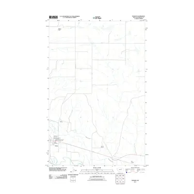
2011 Map of Dodson
USGS Topo · Published 2011About this map
Milk River irrigation infrastructure defines this portion of Phillips County, where the Dodson North Canal and Dodson Pump Canal branch away from the main waterway to support the region's agricultural vitality. The small town of Dodson serves as the central hub, anchored by the Dodson Post Office and the Phillips County Fairground. The influence of the railroad is clear at the Burlington Northern Overpass Bridge, while local community services are represented by the Phillips Co Vol Fire Company Peoples Creek Dodson Sta. To the north, the terrain becomes more varied with labels like Spring Coulee and Hay Coulee marking the drainage patterns of the high plains. Local history and genealogy interest is found at Hillside Cemetery, located just north of the town center along N Dodson Rd.
Find a feature on this map
14 named features on this map. Tap any name to fly to it.
Don’t see what you’re looking for? This feature index may not catch every label — zoom into the map to look around manually.
Map Details
Editions of this 2011 Dodson Map
This is the sole edition of this map. No revisions or reprints were ever made.
Other maps of this area

1920 · Avery
USGS Topo · 1:125,000

1953 · Havre
USGS Topo · 1:250,000

1957 · Havre
USGS Topo · 1:250,000

1958 · Havre
USGS Topo · 1:250,000

1964 · Dodson NE
USGS Topo · 1:24,000

1964 · Coburg SE
USGS Topo · 1:24,000

1964 · Dodson
USGS Topo · 1:24,000

1964 · Cow Creek
USGS Topo · 1:24,000

1964 · Dodson Dam
USGS Topo · 1:24,000

1965 · Wagner
USGS Topo · 1:24,000