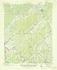
1935 Map of Doe Mountain
USGS Topo · Published 1935About this map
Mountain City serves as the primary hub of this 1935 Tennessee Valley Authority survey, situated at the base of the massive Doe Mountain ridge. The landscape is defined by its early mid-century social infrastructure, with dozens of family-named schools and churches like Shouns Chapel Sch and Dyson Grove Ch anchoring the hollows. The Watauga River winds through the southwestern corner, passing the town of Butler and its Watauga Academy.
Find a feature on this map
129 named features on this map. Tap any name to fly to it.
Don’t see what you’re looking for? This feature index may not catch every label — zoom into the map to look around manually.
Map Details
Editions of this 1935 Doe Mountain Map
2 editions found

Other maps of this area

1891 · Roan Mountain
USGS Topo · 1:125,000

1891 · Abingdon
USGS Topo · 1:125,000

1893 · Cranberry
USGS Topo · 1:125,000

1894 · Roan Mountain
USGS Topo · 1:125,000

1894 · Abingdon
USGS Topo · 1:125,000

1895 · Cranberry
USGS Topo · 1:125,000

1897 · Bristol
USGS Topo · 1:125,000

1899 · Cranberry
USGS Topo · 1:125,000

1902 · Bristol
USGS Topo · 1:125,000

1902 · Cranberry
USGS Topo · 1:125,000