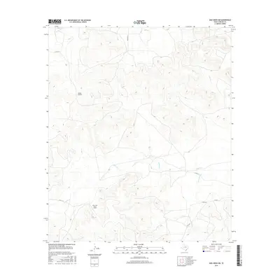
2016 Map of Dog Creek NW
USGS Topo · Published 2016About this map
James Hollow and the surrounding high plains of Sterling County define this landscape as it appeared in the mid-2010s. The area is dominated by ranching infrastructure and intermittent watercourses, most notably the winding paths of Mulberry Cr and its tributary, Little Mulberry Cr. These drainages carve through the terrain, illustrating the natural watershed patterns of West Texas. Evidence of aviation and land management is centered at the Alvie Cole Ranch Airport, a private facility serving the local agricultural community. Transport through this sparsely populated region is facilitated by a network of county roads, including Co RD 114-P and Co RD 120-P, alongside the more established FM 2034. The survey details a landscape where modern ranching operations continue to utilize traditional landmarks like Coyote Cr for orientation and boundary-marking.
Find a feature on this map
11 named features on this map. Tap any name to fly to it.
Don’t see what you’re looking for? This feature index may not catch every label — zoom into the map to look around manually.
Map Details
Editions of this 2016 Dog Creek NW Map
This is the sole edition of this map. No revisions or reprints were ever made.
Other maps of this area

1954 · San Angelo
USGS Topo · 1:250,000

1958 · San Angelo
USGS Topo · 1:250,000

1963 · Cumbie Draw
USGS Topo · 1:24,000

1965 · San Angelo
USGS Topo · 1:250,000

1972 · Sterling City
USGS Topo · 1:24,000

1972 · Dog Creek NE
USGS Topo · 1:24,000

1972 · Dog Creek SW
USGS Topo · 1:24,000

1972 · Broome
USGS Topo · 1:24,000

1972 · Dog Creek NW
USGS Topo · 1:24,000
1972 · Dog Creek
USGS Topo · 1:24,000