
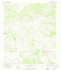
1972 Map of Dog Creek NW
USGS Topo · Published 1975About this map
The West Texas landscape of Sterling County is defined by its deep drainage patterns and ranching heritage in this 1970s survey. Large ranching operations like McClure Ranch in the northwest and Alvie Cole Ranch to the south anchor the local geography, connected by unimproved roads and private Landing Strips. The topography is dominated by the winding paths of Mulberry Creek and Coyote Creek, which have carved intricate contours into the terrain. Industrial footprints are visible through scattered oil wells and a dedicated gravel pit, indicating the local extraction economy of the era. The presence of the label Humble near the eastern margin suggests petroleum activity tied to the namesake energy company, while names like James Hollow and Little Mulberry Creek record the localized nomenclature used by families working this land for generations.
Find a feature on this map
11 named features on this map. Tap any name to fly to it.
Don’t see what you’re looking for? This feature index may not catch every label — zoom into the map to look around manually.
Map Details
Editions of this 1972 Dog Creek NW Map
This is the sole edition of this map. No revisions or reprints were ever made.
Other maps of this area

1954 · San Angelo
USGS Topo · 1:250,000

1958 · San Angelo
USGS Topo · 1:250,000

1963 · Cumbie Draw
USGS Topo · 1:24,000

1965 · San Angelo
USGS Topo · 1:250,000

1972 · Sterling City
USGS Topo · 1:24,000

1972 · Dog Creek NE
USGS Topo · 1:24,000

1972 · Dog Creek SW
USGS Topo · 1:24,000

1972 · Broome
USGS Topo · 1:24,000
1972 · Dog Creek
USGS Topo · 1:24,000
1973 · Coon Dive Draw
USGS Topo · 1:24,000