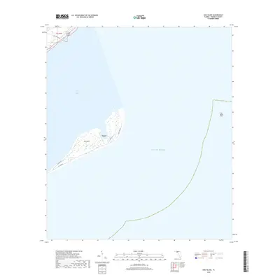
2018 Map of Dog Island
USGS Topo · Published 2018About this map
Dog Island sits as a narrow barrier between the Gulf of Mexico and Saint George Sound in this 2018 survey. The island's geography is defined by its isolation and specialized infrastructure, notably the centrally located Dog Island Airport and a small network of coastal roads including Gulf Shore Dr and Bayshore Dr. This map illustrates the intersection of maritime features like the submerged Dog Island Reef with the terrestrial marshlands and residential lanes such as Lubber Ln. The small portion of the mainland visible in the northwest corner shows the proximity of Lake Morality Rd, highlighting the coastal transit patterns of Franklin County. The map provides a precise view of the island's shoreline and wetland topography just before the turn of the decade.
Find a feature on this map
9 named features on this map. Tap any name to fly to it.
Don’t see what you’re looking for? This feature index may not catch every label — zoom into the map to look around manually.
Map Details
Editions of this 2018 Dog Island Map
This is the sole edition of this map. No revisions or reprints were ever made.
Other maps of this area

1943 · Dog Island
USGS Topo · 1:31,680

1943 · Carrabelle
USGS Topo · 1:24,000

1943 · St. Teresa Beach
USGS Topo · 1:24,000

1944 · Pickett Bay
USGS Topo · 1:31,680

1944 · Carrabelle
USGS Topo · 1:31,680

1944 · Sugar Hill
USGS Topo · 1:31,680

1945 · Mc Intyre
USGS Topo · 1:31,680

1945 · Sugar Hill
USGS Topo · 1:31,680

1945 · St Teresa
USGS Topo · 1:31,680

1945 · Pickett Bay
USGS Topo · 1:31,680